Gazetteer of the Western Front: Frémicourt

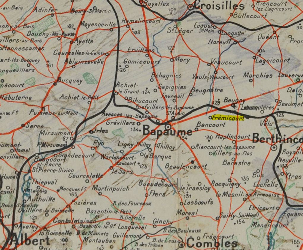
Location and pre-war history

Present-day map. Frémicourt lies 5km north east of the town of Bapaume, just off the main Route Nationale N30 road to Cambrai and near to Junction 14 of the A1/E15 motorway. It is served by Bus number 526 from Bapaume or Cambrai centre. Frémicourt is within the Departement of Pas de Calais. Local inhabitants are known as Frémicourtois (male) or Frémicourtoises (female).

Frémicourt can trace some history back to at least the 1300s but never developed beyond being a rural, agricultural, hamlet and even by 1911 had a population of just 382. Before 1914, a standard gauge railway from Albert and Achiet-le-Grand passed the village on its northern side, going eastwards to Hermies, Marcoing and Cambrai.

Contemporary map. Illustrates very well the railway line that passed the north of the village.

Great War history

Frémicourt came into the war when German forces under Crown Prince Rupprecht advanced towards Bapaume on 26 September 1914. A subsequent clash with French forces and eventual stabilisation of the front left the village well behind German lines. It became used for billeting and organisation of supply for German forces on the Somme front.

From a British grid map dated 27 November 1916. Intelligence from air reconnaissance had detected barbed wire defences to the west and south of the village.

Frémicourt is recaptured after Germans withdraw

The eastwards shift in position that resulted from the German strategic withdrawal from the Somme to the Hindenburg Line (Unternehmen [Operation] Alberich) in March-April 1917. The dark blue lines mark the British front line on 17 November 1916 (at the end of the Battle of the Somme) and 8 April 1917. Note the German defensive position known to the British as the Beugny-Ytres Line which ran close to the east of Frémicourt.

Operation Alberich not only included the deep withdrawal to the Hindenburg Line but the systematic destruction by the Germans of the area being given up. This was to hinder the British follow-up, and render the ground as operationally difficult as possible. Vilages were razed, railways and roads blow up, water sources poisoned, buildings, dugouts and trenches booby-trapped.

Several British newspapers ran an article on 3 May 1917 that outlined details from captured German documents. This extract gives the chilling timetable for the deliberate destruction of the village as part of “Alberich”. (British Newspaper Archive). British Fifth Army reported that its Royal Flying Corps units had observed big fires in Frémicourt at 11am on 17 March 1917. Later that day it reported further observations that Frémicourt Halt had been destroyed and there was now a large crater at the railway crossing. At 2.48pm next day, air observers could see no sign of any enemy in the village.

At 5.10pm on 18 March 1917, I ANZAC Corps reported to Fifth Army that a brigade of 5th Australian Division had advanced through Frémicourt but was now held up by enemy fire from Delsaux Farm (near Beugny).

I ANZAC first orders the advance to Frémicourt. (War diary, Australian War Memorial).

The village would remain in Briitish occupation until 24 March 1918. As the advance pressed on in the wake of the German withdrawal in March 1917, Frémicourt fell further into the rear and became the location of camps, formation headquarters, medical units, supply dumps and (particularly to the east towards Beugny) surrounded by batteries of heavy artillery. It demanded a huge amount of labour and logistical effort to turn the devastated area habitable and to provide goods lines of communication to the new forward area.

Australian War Memorial photograph P01835.021. With thanks. “Frémicourt. Houses damaged by enemy bombardment lining a road in the town which is located northeast of Bapaume. The road has been cleared of debris and rubble”.
Australian War Memorial photograph E00468. With thanks. “Numbers 6 and 8 Platoons, B Company, 4th Australian Pioneers shifting camp from the Butte de Warlencourt to Frémicourt by light railway. This photograph was taken at a small siding about a mile from the Butte towards Bapaume. The timber on the third truck and the two rear trucks was salvaged from a German dump at the Butte de Warlencourt”.
Imperial War Museum photograph 61221. With thanks. “Grand Rue in Frémicourt, 1 July 1917.” Grand Rue is now the D7E2 road that runs through the middle of the village. The camera is facing eastwards. The tall building on the left is the Roman Catholic church of  Saint-Amand. By this date it was roofless, gutted and in ruins. The road had been cleared since the village had been captured and a huge pile of debris had been made on the left of the church (just off camera: photograph Q61220 shows this debris).

Frémicourt falls to the German 1918 spring offensive “Michael”

British Official History. The German attack of 21 March 1918. Frémicourt is held by IV Corps, with 51st (Highland) Division and 6th Division holding the forwards area that came under attack. The solid black marks the British front before the attack; by day’s end, it had been pushed back to the dashed line. The 11th (Service) Battalion of the Lancashire Fusiliers had been camped at the village for several days, and on 21 March was ordered forward to help man the defence of the Beaumetz area.

Some German progress was made on 22 March, and the 1/4th Battalion of the King’s Shropshire Light Infantry moved up into Frémicourt from Beaulencourt (arriving in the early hours of 23 March).

British Official History. 23 March 1918. Frémicourt was now manned by a variety of units, some falling back from the front, some arriving from the rear. The front line had been pushed back to between Beugny and Frémicourt, and on this day the Germans made good progress south of the main road to Cambrai.
IWM photographQ8605. “6-inch 26cwt howitzers of the 244th Siege Battery, Royal Garrison Artillery in action at Biefvillers (NW of Bapaume), 23 March 1918”. The battery is firing to cover the approaches to Beugny and Frémicourt. Note the wide-open views in the distance, which are typical of this area.
British Official History 24 March 1918. Solid black is the British front at dawn; dotted chain black behind it is a second defensive line. On this day, German pressure forced a British withdrawal, giving up the area and falling back through Bapaume onto the eastern edge of the old 1916 battlefield of the Somme. Frémicourt fell back into German hands as the divisions of VI and XIV Reserve-Korps advanced through it and would remain as such (eventually some miles behind the restabilised front line) until the summer.
British grid map at 27 May 1918. It reveals the extensive construction of railway sidings and light railways that had been built before the village fell back into enemy hands.

Frémicourt recaptured for the final time

British Official History. Illustrating progess made by Allied forces in the “Hundred Days Offensive” of summer and autumn 1918. The village lay in the path of Third Army and was recaptured by the New Zealand Division on 31 August 1918.
IWM photograph Q23924. A German photograph from the Theodore Gieser collection. “German A7V tanks, probably in Frémicourt, 31 August 1918. The one on the right is named “Hagen”, the other is very likely “Schnuck”.
British Official History. Illustrating the timed battle lines of the advance in Third Army’s area, during which the village was recaptured.
Neational Library of New Zealand under commons licence. “A general view over the New Zealand Divisional Headquarters at Frémicourt, France during World War I. Shows a number of houses, ramshackle huts and tents with trees in the background. There are many planks of timber and sheets of iron laying on the ground suggesting earlier shell damage. Photograph taken 7 September 1918 by Henry Armytage Sanders”

While occupying the village, the Germans created an extension to the communal cemetery which eventually contained burials of 1,346 of their own soldiers and 136 officers and men from the United Kingdom who fell in March, 1918. It was taken over in September 1918, by British and Dominion units, who used it for clearing the battlefields and for fresh burials, and added 94 graves. All the graves have now been removed to other cemeteries, notably the nearby Bancourt British Cemetery (below).

The sacrifice of Frémicourt was recognised by the award of the Croix de Guerre to the village in 1920.

Frémicourt post-war and today

In the autumn of 1921, Arthur Behrend revisited the area in which is Heavy Artillery Brigade had been in action in March 1918. He added an atmospheric chapter about it, “Reprise” in his famous memoir “As from Kemmel Hill”, and mentioned Frémicourt as his little local train took him from Achiet-le-Grand towards his destination of Beugny.

It was through my ears that I first became aware how times had changed. We had pulled up in the mist. There were some dim buildings, and the guard ran up and down shouting “BeeveeYAY! BeeveeYAY!” Wht was he saying? Trying to tell me that Biefvillers was no longer known as Beef Villas? I was hard to believe, perhaps because I did not wish to believe … None the less it was true.

On again. This mists were lifting. This bit of country looked familiar, and we stopped a second time. “FRAYmeecour! FRAYmeecour”, the guard was shouting now … Frémicourt. But, Fraymeecour or Fraymeecourt, it was the same little hamlet in which the headquarters of 51st and 56th Divisions had lived during our time.

Extract from “As from Kemmel Hill” by Arthur Behrend (London: Eyre & Spottiswood, 1963)
From Swinton’s “Twenty Years After”, this photograph by A. J. Insall shows the newly built church in the 1930s. The site of its predecessor has been cleared and largely levelled, and the church built further back from the road. Some vestiges remained: a small cairn or pile of stone can be seen between the church and telegraph pole.

For the battlefield visitor, there is little see in Frémicourt except for the landscape and the village’s war memorial, inaugurated in 1923. It has no facilities, shops or accommodation, with the nearest being in Bapaume, although there is an evening friterie in Beugny.

The village centre today, as seen in Google Maps. The road layout is similar but the village bears little resemblance to its 1914 counterpart.
Again, Google Maps. Frémicourt as seen from just outside Bancourt.

Bancourt British Cemetery is the nearest to the village and is largely a post-war conentration cemetery that now contains almost 2,500 graves. Not far away are Delsaux Farm and Red Cross Corner Cemeteries at Beugny, and Favreil British Cemetery.

The population of the village is still only around 250-300.

Links

Other places in the Gazetteer of the Western Front

A chaplain in the war: Frémicourtois Camille Vitel (Archives de Pas de Calais)

Musée Ligne Hindenburg